


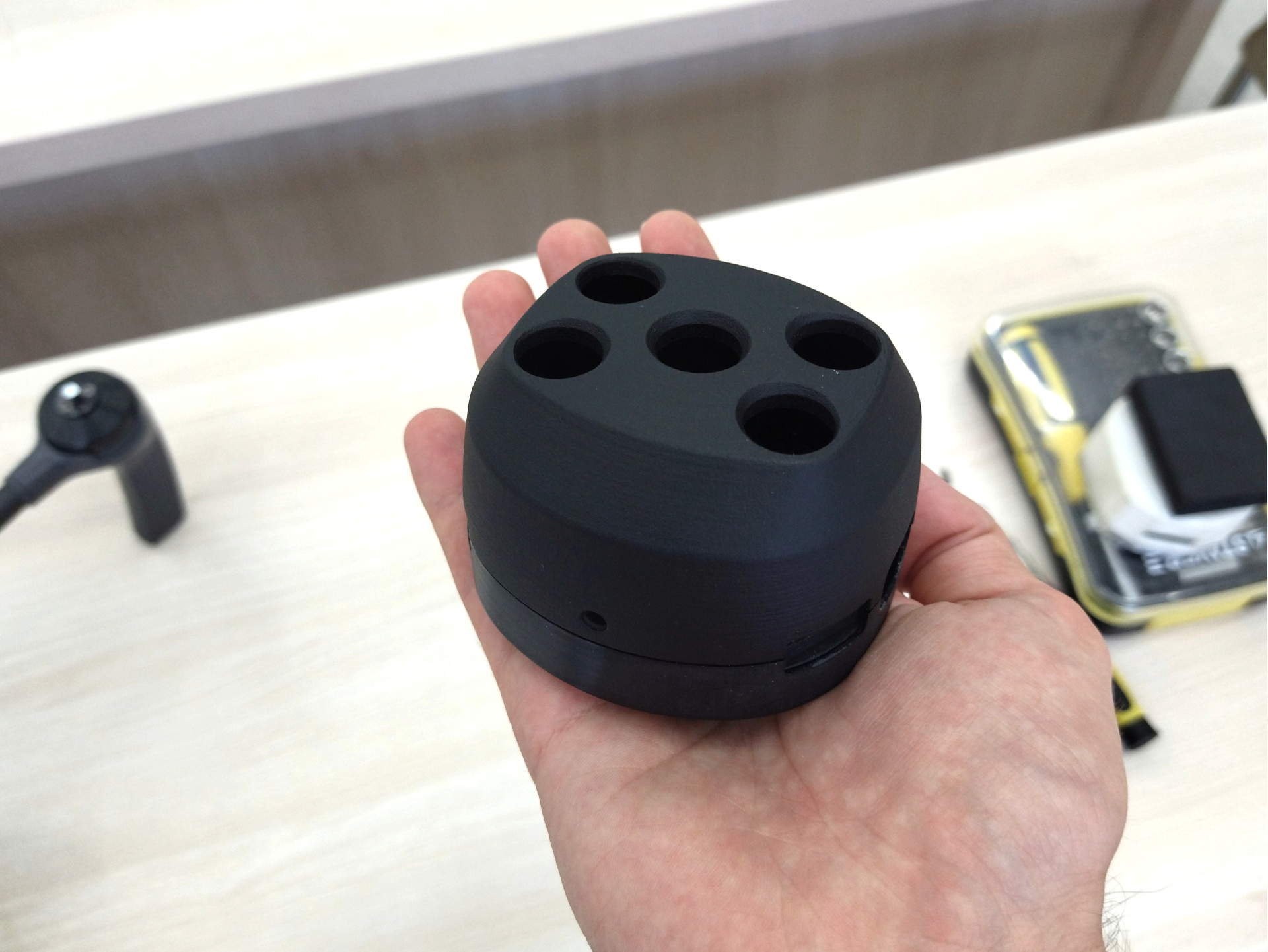
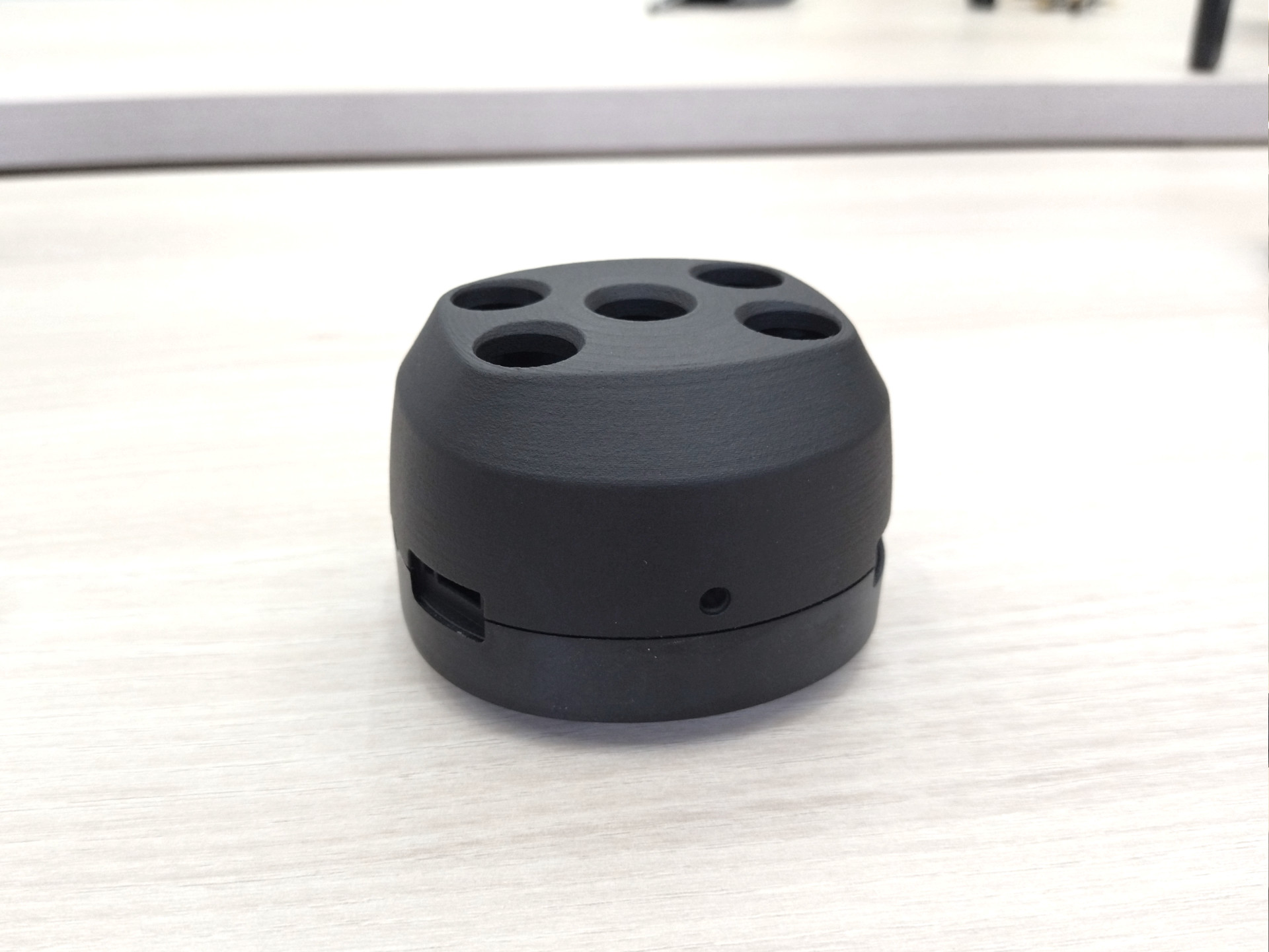
Geoscan Pollux is the first Russian digital multispectral camera for unmanned aerial vehicles. Mounted on a special drone and paired with special software, it is a comprehensive tool for assessing the condition of agricultural land.


Publications
Purpose
At the request of the Geoscan team, we developed an attractive and functional product design for the first Russian multispectral camera for unmanned aerial vehicles.
An important requirement was that it had to fit perfectly with the Geoscan Gemini drone and look good in combination with drones from other manufacturers
Research
We studied the current market for multispectral cameras around the world and analyzed what they have in common, their weaknesses and strengths.


Exploring the Geoscan brand and its aesthetics.
An analysis of the Gemini drone, which was designed SmirnovDesignand the camera will be used by Geoscan.


Exploring and finding inspiration in professional lenses, leaders, photo and video devices.
Focusing on complete alignment with the world of high quality and innovative photography.


It was decided to use a combination of sharp edges and soft surfaces, creating the image of a professional and serious device, but with a pleasing shape.
Our goal is to create a device with a design that conveys a sense of "innovation", looks user-friendly and comfortable for the user.
Conceptual design
The complexity of this project is that both internal and external size constraints are very strict.
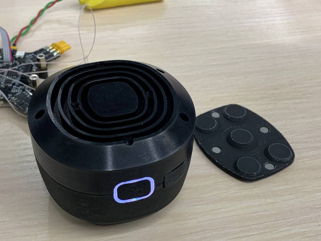
We have to put all the electronics inside the camera, while it has to fit inside the already manufactured product.
This becomes a challenge as the overall design needs to be attractive and competitive.

All concepts are presented in the same color scheme, this helps to accentuate the shape and make it easier for the customer to see.
Instead of exquisite sketches, we provide first works with conceptual but accurate 3D models and renderings.
In this way, the Geoscan team is able to simultaneously evaluate implementation, aesthetics, and manageability.


After review and analysis, the Geoscan team selects the best design direction, inspired by several other concepts and important insights from the collective brainstorming sessions.
Building on the accumulated knowledge and feedback, we continue the process.
Design Development
Together with the Geoscan team, we refine the design based on our observations, and collaborate to mutually adapt the design and electronics until they are a perfect fit.

Geoscan engineers conduct their designs using our parametric CAD models as inputs and references.
We follow it by clarifying the necessary details and providing visual and numerical guidance to maintain the desired level of design quality as the development progresses.


Prototyping and testing
The Geoscan team creates prototypes and we, in turn, engage in several stages of refinement and design refinement until the final work takes shape.


CMF Design and Graphics
Once the shape, ergonomics, and physical details of the camera are defined, we move on to graphics and CMF design.
We define all elements of the camera surface: colors, finishes, and placement of graphic elements such as signs, logos, and icons.
We document the results of the project in an informative design presentation.
It is used by the customer as a reference document when communicating with the manufacturer.


Prototype functionality
The Geoscan team begins testing the prototype on a drone.
All parties are completely satisfied with the outcome.


