


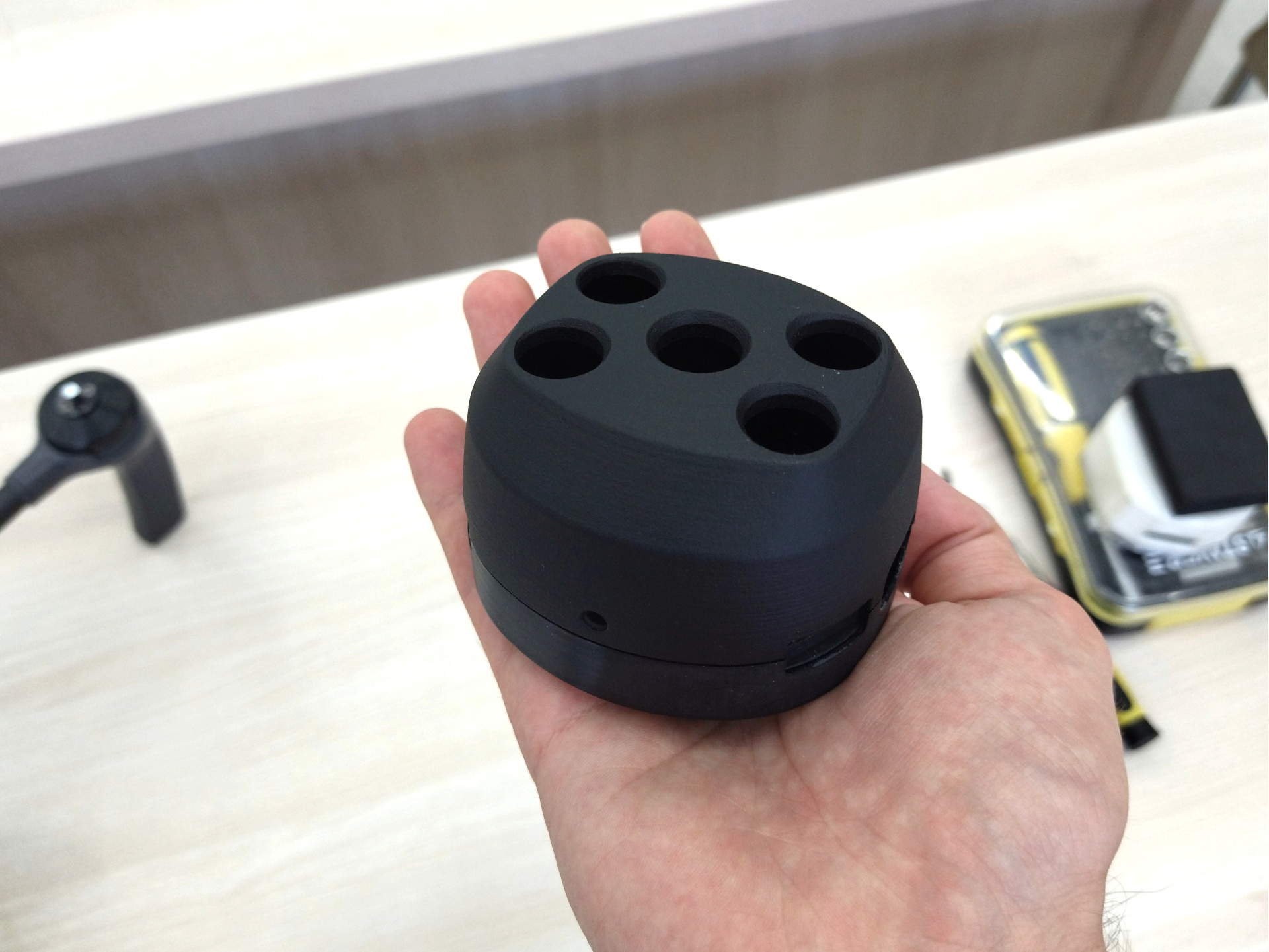
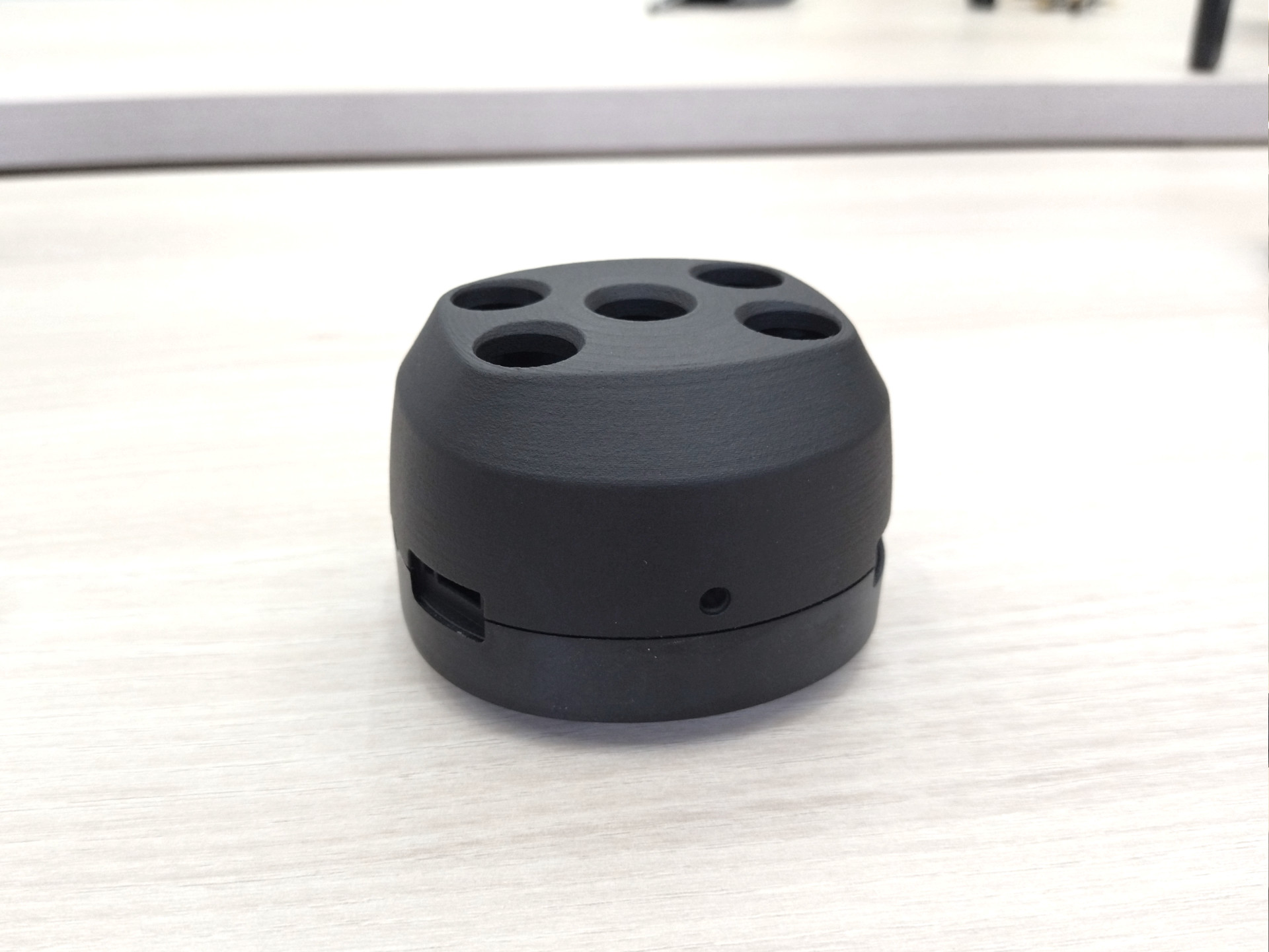
Geoscan Pollux – это первая российская цифровая мультиспектральная камера для беспилотных летательных аппаратов. Установленная на специальном дроне и сопряженная со специальным программным обеспечением, она представляет собой комплексный инструмент для оценки состояния сельскохозяйственных угодий.


Публикации
Цель
По просьбе команды Geoscan мы разработали привлекательный и функциональный дизайн продукта первой российской мультиспектральной камеры для беспилотных летательных аппаратов.
Важным требованием являлось то, что он должен идеально сочетаться с дроном Geoscan Gemini и хорошо смотреться в сочетании с дронами других производителей
Исследование
Мы изучили текущий рынок мультиспектральных камер по всему миру и проанализировал, что у них общего, их слабые и сильные стороны.


Изучение бренда Geoscan и его эстетики.
Анализ беспилотника Gemini, который был разработан SmirnovDesign, с его помощью камера будет использоваться Geoscan.


Исследование и поиск вдохновения в профессиональных объективах, лидерах, фото- и видеоустройствах.
Фокусирование на полном соответствии миру высококачественной и инновационной фотографии.


Было принято решение использовать комбинацию острых краев и мягких поверхностей, создавая образ профессионального и серьезного устройства, но с приятной формой.
Наша цель – создать устройство с дизайном, который передает ощущение “инновационности”, выглядит удобным и комфортным для пользователя.
Концептуальный дизайн
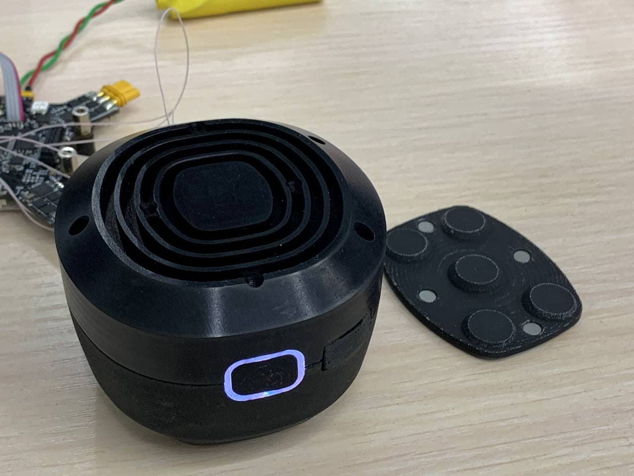
Сложность этого проекта заключается в том, что как внутренние, так и внешние ограничения по размерам очень строгие.
Мы должны поместить всю электронику внутрь камеры, в то время как она должна поместиться внутри уже изготовленного продукта.
Это становится сложной задачей, поскольку общий дизайн должен быть привлекательным и конкурентоспособным.

Все концепты представлены в одной цветовой гамме, это помогает подчеркнуть форму и облегчить обзор для клиента.
Вместо изысканных набросков, мы предоставляем первые работы с концептуальными, но точными 3D-моделями и рендерами.
Таким образом, команда Geoscan имеет возможность одновременно оценить реализацию, эстетику и управляемость.


После обзора и анализа команда Geoscan выбирает оптимальное направление проектирования, вдохновляясь несколькими другими концепциями и важными идеями, полученными в результате коллективных мозговых штурмов.
Опираясь на накопленные знания и обратную связь, мы продолжаем процесс.
Разработка Дизайна
Совместно с командой Geoscan, мы дорабатываем дизайн на основе наших наблюдений, а также сотрудничаем во взаимной адаптации дизайна и электроники, пока они не станут идеально подходящими.

Инженеры Geoscan проводят свои разработки, используя наши параметрические модели САПР в качестве исходных и справочных материалов.
Мы следуем ему, уточняя необходимые детали и давая визуальные и числовые рекомендации, чтобы сохранить желаемый уровень качества проектирования по мере продвижения разработки.


Создание прототипов и тестирование
Команда Geoscan создает прототипы, а мы, в свою очередь, занимаемся доработкой в несколько этапов и усовершенствованием дизайна, пока финальная работа не обретет нужную форму.


Дизайн и графика CMF
После того, как форма, эргономика и физические детали камеры определены, мы переходим к графике и CMF дизайну.
Мы определяем все элементы поверхности камеры: цвета, отделку и расположение таких графических элементов, как знаки, логотипы и иконки.
Мы документируем результаты проекта в виде информативной презентации дизайна.
Она используется клиентом в качестве справочного документа при общении с производителем.


Функционал прототипа
Команда Geoscan начинает тестировать прототип на беспилотнике.
Все стороны полностью удовлетворены результатом.


